Derbyshire Border Walk – section 6
Long Eaton to Kings Newton 11 miles (see map on Google)
With two companions for this section we used cars to link end to start and were off walking by 10am. It promised to be another easy day which was a relief because sciatica was causing me some discomfort although exercise, I was advised, is a good cure.
The wide surfaced towpath of the Erewash canal allowed for walking abreast and chat but we had to be vigilant where our feet were placed to avoid dog deposits while listening out for the ting of cycle bells. There was perhaps lots to see along this busy stretch but there was also much news to convey so the scenery passed by virtually unnoticed.

Moored boat on the Erewash canal. Read with care!
The section south of the Tamworth Road bridge always brings back childhood memories of visits to my aunt, uncle and cousins who lived close by. This was the local waterway to dip in the fishing net and fill a jar of sticklebacks. I don’t recall ever seeing a boat pass to disturb the crystal clear water.
At Trent Lock I met two other friends who were attempting to rescue and separate river and canal swans that had become trapped in the empty lock and did not appreciate being in each others company. I also received the shocking news that a video has been posted on Youtube of me Morris Dancing, I’ll say no more and hope you can’t find it.

The Trent looking upstream Sawley church spire on the right
The canal ends as it meets the River Trent at this popular tourist destination. Fairly quiet today but the Canal and River Trust chuggers are here and only have us to pounce on. We have strayed from the border which followed the river Erewash and joins the Trent some three miles down stream. Nevertheless it is still a meeting of three counties. To our right the Soar joins the Trent so we can see Nottinghamshire, Redhill and the cooling towers of the power station On the bank opposite is Leicestershire and fields through which we trudged on the Leicestershire Border Walk.
Crossing the footbridge alongside the railway we pass over the main river channel and the boundary. I had never realised before that Sawley Lock and the long established Derby Motor Boat Club moorings are all in Leicestershire. Crossing the old A453 Nottingham to Tamworth and Birmingham now supplanted by the A and M 42 we come to the flood lock which protects Sawley Cut and all those moorings.
Under the tunnel like motorway bridge, ideal shelter had it been raining, then the lattice bridge which supports two huge pipes carrying drinking water from the Derwent dams to the city of Leicester. This short section of path was part of my Leicestershire Border Walk but this time we pass over the new Long Horse Bridge and back into Derbyshire heading for Shardlow along the Trent and Mersey canal.
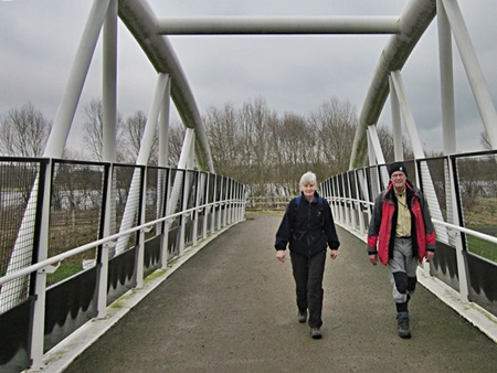
The new Long Horse Bridge requires a small detour
Having made an early start we arrived in the fascinating old inland port of Shardlow before noon but ahead there was nothing so the planned lunch stop had to be taken. Fortunately the New Inn offered a full English breakfast until 12 which would fit the bill perfectly. I wasn’t sure if beer went with bacon but with an excellent choice on the bar I couldn’t resist mixing them. No ill effects I’m pleased to report.

Shardlow an historic inland port
Being on the off bank I deviated from the planned route and followed roads and a footpath through the village, a worthwhile change of scene. After crossing the old A6 (even the roads are all ‘old’ around here) it was back onto the towpath. Riverside House invites a glance through the gap to see we are on a narrow strip of land between river and canal.
 It might appear cheating to take this easy towpath route but inspection of the map shows no alternative field paths and the boundary along the centre of the Trent is only a field or two to our left. The only paths to the river converge mysteriously at a point near Kings Mill but inspection of old maps has the answer showing a ferry and ford once offered a connection.
At Weston Lock we watched a boat climb the twelve feet, having seen few boats on the move Sods Law must have been in play as another boat came from the opposite direction and had to wait to pass down the lock. We took the opportunity here for a break from towpath walking and meandered around the fringe of the village finally taking a cross field path to the church. From this elevated location our view of the Trent valley was improved so it was worth the effort.
Moving on from the church we passed through Tarasivka as marked on the map. This we discovered is a Ukrainian Youth Centre which took over an army camp after the Second World War. The Social Club which stands on a bank above the canal is now only open on a Sunday, so the sign informed us but earlier maps show this was an Inn long before the military used the site. This was also a wharf on the river which might explain the necessity for a bridge over the later canal.
We are making good progress today and the end promises a much easier finish than the challenge at Pye Bridge. After passing under the old railway bridge we loop up and around to join the Cloud Trail. This offers very easy walking and a pleasant crossing of the Trent valley with stone built flood arches and a delicate iron river bridge. The line was opened in 1867 and closed in 1982, a sign tells us but looking at the map it’s difficult to understand why it was ever built as it twists around north west Leicestershire. Coal and stone is the most likely explanation with the stations at Melbourne and Tonge a token gesture to locals. The name of the trail perhaps comes from the last user of the line, Cloud Hill quarry, just north of Worthington.

The former rail bridge over the Trent now a cycle track
So we end this section of the walk at the site of Melbourne station nearly a mile from the parish church and village centre. The might explain why Melbourne’s famous son Thomas Cook didn’t organise the world’s first excursion from his home town. It might also be because this station didn’t open until twenty five years after Cook’s bright idea.

Leave a comment